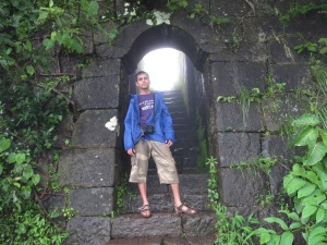
Rajgad – King of Forts

Rajgad – literally means King of Forts! I have been craving to visit this place for years, but somehow was not able to make it. This fort is said to be and is actually a must visit for any trekker! It is huge and majestic. Historically, it is arguably the most important fort with respect to Shivaji maharaj’s fight for Swarajya. Even more important than Raigad.

This slideshow requires JavaScript.

About the Fort
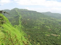
Rajgad, most aptly described as the King of forts. At 1395 metres it literally gives an eagle’s view of the surrounding region. It has three machi’s called Sanjeevani, Suvela and Padmavati. The Bale Killa (Bastion) of this fort is well known for it’s peculiar characteristics. There are many routes to climb this fort. One route can take you from Torna to Rajgad.

The two forts are facing each other and are enjoined by a range of hills. It can be a tiring trek of 8 to 9 hours. The royal route or the Raj rasta comes all the way up from Pali village and takes you through the Pali Darwaja which is located on the northern side. It had broad stone cut steps and is an easy access up the fort.

Presently the most used pathway goes from Gunjavne village and instead of taking us to Gunjavane Darwaja, forks to the right and takes us to Chor Darwaja on Padmavati Machi. Gunjavne Darwaja on the south-east side is not much in use due to thick vegetation surrounding it.

The Day Begins

Rajgad is almost 250 kms from Vasai so it was going to take us any where between 5 to 6 hours of traveling from Vasai to Rajgad Base village. We didn’t had the luxury to push the schedule to the second day. Hence we decided to start at 3:00 in the morning, to give us some extra time. We started accordingly at around 3:00 AM and managed to reach Gunjavne village at around 8:30 AM after spending almost 40 mins for searching this place. After a small snack break, we started our trek at around 9:00.

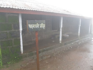
Padmavati Temple

Padmavati Temple

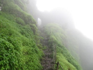
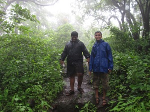
It was raining very heavily,  and the view of the surrounding area especially the valley was getting better and better. The trail from Gunjavne was leading us to Padmavati machi. The peak was covered under fog and hence was not visible until we reached close to it. The path until Padmavati machi is not very difficult with few rock patches in between. The authorities have built iron railings at places wherever it is a bit risky. It took us a couple of hours to reach Padmavati Machi.

On Reaching the Summit

Trail leading to Padmavati Machi

Trail leading to Padmavati Machi

On the summit we can visit four major parts of the fort – the three machi’s and the bale killa. Padmavati machi is broader than the other two, Suvela and Sanjeevani. The ruins of Rajwada, Gunjavne Darwaja, a few temples, Queen Saibai’s tomb and Sadar could be found on this machi . They are fading reminders of the forts glory.

Padmavati temple is in a fairly good state today due to renovation done recently. As one moves away from Padmavati machi with the bale killa on the right there is a small Bhagirathi temple on the other side.

As we move from Padmavati machi keeping the bale killa to our left, we approach Sanjeevani machi.  This machi is enjoined with Budhala machi on Torna by a range of hills between the two huge forts. Since we were running short of time, we skipped the Sanjeevani and Suvela machi and moved directly towards the Bale Killa.

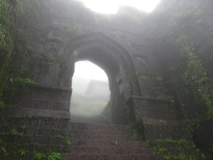
Bale Killa is the crown of Rajgad. It has a unique triangular structure and a single point access. The tricky section is a vertical climb of around 20-25 feet with small holds in the cliff. It is a road to heaven on the slightest mistake. The authorities have tried to build some railings, but the trail remains risky. But the risk is worth the view on top. After climbing the difficult section, we reach the Maha Darwaja. After killing Afzal Khan, his head was sent to Rajgad and was buried near this door following all religious processes. There are a couple of temples, and a small crescent shaped lake called Chandratale on the bale killa. It offers an enchanting view of Padmavati, Sanjeevani and Suvela machi.

For almost 25 years this fort was Shivaji Maharaj’s capital. Rajgad boasts of the highest number of days stayed by Chhatrapati Shivaji Maharaj on any fort. The fort has witnessed lots of historic events, including the birth of Shivaji’s son Rajaram, the death of Shivaji’s Queen Saibai, the return of Shivaji from Agra, the burial of Afzal Khan’s head in the Mahadarwaja walls of Ballekilla.

Mahadarwaza, rajgad

Maha Darwaza

This fort was also one of the 12 forts that Shivaji kept when he signed the Treaty of Purandar (1665) with the Rajput king Jai Singh in 1665 who was leading the Mughal forces. 22 other forts were handed over to the Mughals under this treaty.

We spent some time on the pinnacle and then started descending towards Padmavati machi. We lost our way down to Gunjavne, but fortunately an elderly village lady guided us back till the base village. We had some rest and began our journey back home. We started our journey back at around 3:00 in the afternoon. Taking our morning time as a yardstick we had informed our homes that we’ll reach by 9:00. But whatever energy we had in us was further used up in huge traffic which we encountered first near Pune and later again near Thane. Finally we ended up reaching home at 1:30 in the night. It was a long day for us, more than 22 hours. But yes, we had successfully accomplished one of the most challenging treks in our lives. This feeling of accomplishment far surpasses the exhaustion. The King of Forts is any time worth the pain! Continue reading
Trek to Mahuli

Failed on First Attempt

It was 16th Jan 2010, when we (Team NDS) had planned a Trek to Mahuli. It is not that we were trekking for the first time or we had only trekked to smaller forts. Our team had good experience in trekking, but somehow many small unwanted things happened and finally we fell short of reaching our target. We had to retreat after completing almost 90% of our trek. First of all, our train which was supposed to reach Asangoan around 8:00 reached almost an hour late. By the time we reached the foothills it was almost 10:00. After starting the trek, for the first couple of hours we were lost in the jungle (since not many trekkers trek over here in this season, you hardly find anybody to ask directions), going in a completely incorrect  direction. So the actual trek started only after noon, which is quite late given that it is reasonably hot at noon in January. To add to our problems, we were running out of water and had exhausted almost all of it before getting on the correct path. Thanks to the teams commitment, we attempted to reach the top even after such shaky start. But just commitment was never going to be enough. We couldn’t complete it. Slow and steady we almost reached the top. The final bastion was within our sight. But we couldn’t complete it. 😦

The Second Coming

This slideshow requires JavaScript.

Planning for Trek

Coming back to present, as the monsoon had set in on time, all the trekking enthusiast of our office (Team Mphasis) started discussing about possible places for trek. Krishna, my friend, who is leaving our organization in a month, took the initiative and coordinated amongst the team members. After a lot of deliberation we decided to go to Mahuli on 7th July. Since we had sizable number of people who were coming for the trek, we decided to hire a small bus. Every team member was also asked to carry a food item and ample of water.

At The Crack of Dawn
On our way to Mahuli

On our way to Mahuli

The bus was scheduled to leave from Borivli at 6:00. Gagan, Shraddha and Me boarded 5:26 local train from Vasai. Apart from us,  Abhijit, Chetan, Bhavik, Rama and Bhakti too had come to Borivli. Everyone came on time, except the Bus itself. 😉 So after waiting for around half an hour we finally left Borivli and picked others (Rupali, Adarsh, Rushabh, Krishna, Ishita, Neha, Lovjit, Lavanya & Krishna M respectively) on our way.  Santosh was the last one (Eighteenth) to board the bus at Thane. Time was passing but we were having fun in the bus, playing antakshari, having Idli and dosas. Every now and then Rushabh use to come up with his own versions of hindi songs. Followed by Bhavik , with his witty jokes. In an hour we had reached the foothills of the fort.

The Trek Begins

The trek begin at around 9:30. Unlike my previous attempt, when there was hardly any group in that season, this time the crowd was in good numbers. Hence there was no scope of getting lost. Apart from the crowd, there was proper arrow markings at regular intervals for people to follow. At the base itself we were required to cross a stream to proceed further. The climate was pleasant, with dense green forest all around. It was not raining though.  The initial climb was very gentle, but as we went higher it became steeper. Since many amongst us were trekking for the first time and Mahuli being the highest peak in Thane district, Expecting everybody to reach the top would have been quite ambitious. Even then, everybody were climbing with reasonable ease. In around an hour, we had our casualty. Gagan, one of our first timer was fully exhausted. After waiting for a while, he asked us to proceed. Neha who has reasonable experience in trekking, was also not feeling well today. But even after that she managed to complete almost half the trek before giving up. Gagan too, tried his level best to continue, but he was too tired to do so. Ishita had some initial hiccups, but she is not one would give up so easily. She took some rest and in few minutes was back with the team.

Yogesh Lotlikar

Its me! On the way to the fort!

Meanwhile, rest of the team continued without any issues. Abhijt was leading the team. Bhavik was helping Rupali to climb. Notably, Rupali and Bhakti, both first timers, were doing exceptionally well.  Looking at them, no one would have said they were trekking for the first time. Infact Rupali was climbing few of the rock patches with utmost ease. Me and Rushabh were at the end for most part of the trek, helping Lavanya over the difficult patches.

Everything was going on smoothly when suddenly Chetan received a call from Gagan. He was saying there was a snake in front of him. According to him, the snake was not allowing him to make any movement. To add to the problem another snake had come to the scene. Everyone went into a tizzy. Poor Gagan was standing alone in that part of the jungle having two snakes staring at him. We had come a long way from where we had left him. So reaching back to him quickly was not a possibility. Anyways, we were contemplating going back to where he was. Just then he called us back to inform us that he is fine. Luckily two other trekkers were returning back and they helped him out. He went back to base village along with them. Phew! What a sigh of relief!! I have been trekking for so many years now. But such an incident have never ever happened to us. At times we have seen snakes, but they never bother us. This was something unusual. But then, it did happen!

Team Mphasis, After reaching the top of the fort

Team Mphasis, After reaching the top of the fort

By this time, we had almost reached the spot where I had stopped on my first attempt. Lavanya was very tired, she would have stopped there itself if any other team member had agreed to stop with her.;) But, fortunately everyone was excited to reach the top and there was no question of going back from there. Also, Gagan’s incident was fresh in her mind, so stopping alone was also not an option for her. We assured her, we were almost there and won’t take much time to reach the top. But to be honest, the last part of the trek was the most difficult. It was steep and rocky. To top it all, it had started raining heavily by then. But we were determined to make it to the top, and yes, we did it!! All of us had reached the pinnacle by 1:00. It was quite pleasant up there. Mild drizzle accompanied with thick fog, with visibility hardly few meters at times. We had some snacks which we had carried and started our descend in some time.

About Mahuli

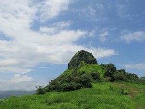
The peak of this fort is the highest point in Thane district of Maharashtra. The origin of this fort is not known. The forest around this fort is declared as a protected sanctuary. The view from the top is amazing. Due to heavy fog the adjoining pinnacles were not visible though.

When Shahaji Raje became the secretary of Nijamshahi, Adilshahi and Mughals of Delhi together tried to end Nijamshahi. In the year 1635-36, in difficult circumstances Shahaji Raje transferred himself with Jijabai and Shivaji to Mahuli. Khan Jaman, son of Mahabat Khan beleaguered this fort. Shahaji Raje asked for help to Portuguese. They refused and Shahaji Raje surrendered himself.

Shivaji Raje took this fort from Mughals on 8 Jan 1658. In treaty of Purandar, in 1665, Marathas lost these forts again. On 16 June 1670, after two months, Moropant Pingle conquered the forts and Mahuli, Bhandargad and Palasgad became part of Swarajya.

The Descend
Rushabh & Bhavik, relaxing in river water

Rushabh & Bhavik, relaxing in river water

Usually it takes less than half the time it takes to climb any fort. But at Mahuli it was not that easy. The ladder at the top allowed just 2 people to either climb or descend at a time, thus creating a kind of bottleneck. It was raining erratically, making things a bit difficult for us. The trail had become quite slippery. But apart from 2-3 incidents of slipping and falling down, no one else was hurt. Before getting back to the bus, we had some fun in the stream. After all the physical exertion we had been through since morning,this was a welcome break for us. Anyways, this is how we completed our trek. For me, it was a kind of personal score which had to be settled.

Trek to Tikona

This slideshow requires JavaScript.

A little late though, today I have decided to complete the post on our trek to a small fort called Tikona. As has been the trend, we start discussing about treks with the onset of monsoon. Accordingly, we came out with two possible destinations for our trek, Tung and Tikona. Tung being very easy, our friend Praphulla suggested us to go for Tikona. So we finalized on the latter. The date for the trek was 25th Aug.
As per plan Vishal and Siddesh(Sid) came down all the way to Vasai, so the three of us started from Vasai in my car. Mandar(Mandy), Vidya, Devendra(dev), Shraddha and Khyati came in Mandy’s car from Kandivli. We met at Ghodbander and proceeded further towards Navi Mumbai. We picked up Samir(Bhai) and Mukesh(Mukya) on our way. Mukya made us wait for some time but he got us some freshly made “Aluwadi”, “Jalebi” and “Samose” :). So it more than made up for the time lost.

Fort Tikona as seen from foothills

Fort Tikona as seen from foothills

We had targeted to start the trek by 9:30 -10:00, but we were running late by a huge margin. We took the Karla exit on the expressway and proceeded towards Kamshet on the old Mumbai-Pune highway. At Kamshet we took a right turn towards Pawana nagar which is around 15 kms from Kamshet. Tikona Peth (Base village) is around 7 kms ahead of Pawana Nagar. No one amongst us had been to this place before, so finding our way to the foothills cost us some valuable time. The road from Kamshet till the base village may be just 20-25 kms, but is narrow and not in a good condition. Finally we reached the base village after 11:30. A villager allowed us to park the cars in his backyard and so, we started our trek only after 12:00. The trek as such was easy, but after driving for almost 5 hrs, we were feeling a bit tired.

After walking for some time, there was a board giving directions towards the fort on the right hand side. This is where the ascend to the fort started. The climb is gradual with some minor rocky patches. The atmosphere was amazing, it didn’t rain even a bit, the sky was clear with the sunray’s  falling on the lush green grass around giving it a kind of glow. The afternoon sun was shining on us too but the cool breeze was more than sufficient to offset it. After ascending for  around 15 mins, we were able to see the Pawana lake which is close to the fort.

Steps leading to the main bastion of the fort

Steps leading to the main bastion of the fort

Khyati, amongst us, was the first one to get exhausted, so she decided to rest for a while. Mukesh was waiting with her. Rest of us continued with the trek. Shraddha, who was probably on her first trek, was most excited and was leading everybody. On our way we found a cave followed by statue of lord hanuman near a cave.  In just about 45 mins we had reached base of main bastion. We had tea from a vendor and relaxed for some time before advancing for the final leg of the trek.

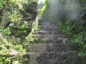
The final leg had some 100 odd steep steps which are to be climbed. Unlike our normal steps these were a tad tricky. There is one wire on the side wall throughout the length of the steps. One has to hold on to this wire while climbing the steps for going up “safely”. We took 10 more minutes to reach the pinnacle of the fort.

Standing on the top, you get a spectacular 360 degree view of the surrounding area. Pawna lake surrounds the fort from Western and Northern side. There is a valley on the eastern side whereas a cliff connects the fort with an adjacent mountain from south. Beyond the lake on the northern side we can see the twin forts of Visapur and Lohgad forming a formidable wall. Fort Tung, which is surrounded on three sides by Pawna lake can be seen on the west. Korigad lies to south western side of the fort, but it could not be seen due to heavy fog. There is also a small temple on the fort.

Cliff on the other side

Cliff on the other side

We had some snacks which we had carried with us and after some sight seeing we started our descend from the fort. It hardly took us 45 mins to get back to our cars. We started our return journey at around 3:30. While returning back, we took a different route. We took a left from Pawana Nagar. This road runs on the perimeter of Pawna lake for almost 8-9 kms. The road was narrow , quite curvy and full of potholes, so our speed was well in check. The view along the route was breathtaking. It goes pass Lohgad and further into Lonavla city. Since we had not had our lunch, we took a break at Mcdonalds on the Expressway. It was dark by the time we reached Airoli. I was feeling a bit worn out, so Vishal drove my car for the remaining part. We reached Vasai station by around 8:30. Mandy, meanwhile had reached Borivali. So, this is how we completed our small but tiring trek to Tikona! 🙂

Trek to Kohoj

This slideshow requires JavaScript.

The year end celebration, this time round were some what muted due to various reasons. We didn’t had any specific plan for the 31st. Hemant and me had a discussion on Monday(31th Dec) about a small trek nearby for the next day. Based on that, I found Kohoj, a fort never heard of before. According to the limited information which I could gather, this trek was supposed to be easy. It was somewhere on the road from Manor to Wada. Around 70kms from Vasai. Ideal candidate for what we were looking for. After a brief discussion, we finalized on Kohoj.
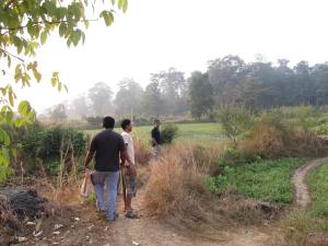
Since this was a last minute plan, only Sachin and Prasad apart from us were available for the trek. As per plan I started off at the crack of dawn from my home, picked up Hemant and Sachin on our way to Virar for Prasad. Usually, for most of our treks, we travel towards Pune. Hence Prasad comes all the way to Vasai so as to proceed further. This was the first time we were picking him up from his home. This may sound a bit silly, but he was really happy about this one off exception. 🙂 Everybody was on time, so by 6:30 we were cruising on the Mumbai-Ahmadabad highway towards Manor. We took a right turn at Manor leaving the highway behind. Our next target was a small village named “Vaghote”. It is around 9 kms from Manor. Since it was early morning, there were hardly any people on the road to ask directions. Unfortunately Google maps had let us down, even it was not able to locate the tiny hamlet correctly. Finally we found a guy who told us that we had came around 2-3 kms ahead. Even after going back it took us some time to find a good place to park our car and to find the path towards the fort. We lost almost half hour in this activity. The fort was hidden in early morning haze.

Path Leading into the forest

Path Leading into the forest

We proceeded towards the fort based on the instructions we had got on our way. After around 10 – 15 mins the fort was quite clearly visible. As I had mentioned at the very beginning, this was supposed to be an easy trek. But, just at its first sight, honestly speaking, we were taken aback. It is not a tough one though,  but nowhere close to easy either. Another reason for our anxiety was that we were not carrying enough “water”.  We were left with just a half liter bottle of water and a sole orange in my bag,  thats it. Biggest possible blunder for any trekker. Such a basic necessity but the thought never crossed any of our minds till we saw the fort for the first time.

Demoralized though, we proceeded towards the fort. The atmosphere was very pleasant with early morning dew settling on grass and giving it the typical essence we find in forest or farms.  In some time we had crossed a small dam below the fort. The trail goes along the perimeter of the lake into the forest. After around 30 mins into the forest, we came across few villagers who were collecting firewood’s. They guided us on the trail ahead. But after climbing few minutes we reached a dead end.  The fort’s huge natural wall was just in front of us, but there was no trail which could have lead us ahead. We had to split in group of two, to explore in two different directions. But that effort too was fruitless. Finally we come down back to the villagers and requested them to guide us further.

By now even the sun had risen quite a bit, and despite the dense forest we were feeling the heat. The villager took us through a trail which we could have never found. Since not many people visit this fort at this time of the year, the trail was kind of lost in the bushes. The path we had taken previously was going straight towards the fort where it meets the wall. The actual path circumnavigates the hill. The villager took us through the thick vegetation upto a place where the path ahead was clearly visible. The trail ahead from here was quite steep. After another 15 odd minutes we met another villager. He told us that it would take another 45 minutes to reach the top. From that point we were able to see a cliff which was probably at a distance of 10 mins. We were puzzled a bit as to why did he say 45 mins for such small distance. But the riddle got solved when we covered those 10 mins. We realized, we had covered only half the distance until that point and the actual top  was visible only now. Infact the 45 mins which he said seemed to be very aggressive. Prasad, by now was totally worn out. He had whatever was left in the half liter bottle we had with hope that we will find some water at the top.  Halting after every few minutes, we finally made it to the top :).  We were happy, we made it. But the feeling of triumph was diminished to a great extent when we came across the two cisterns at the top. There was water in them, but nowhere close to potable. Infact it was not even good enough to wash our faces. We had the sole orange still remaining, giving us some respite.

After spending some time, we started our return journey. We thought we could make it to the base in an hour, since it doesn’t take much time while declining. But this was not to be. There was still some anguish left for us. After reaching almost half way, we met a village lady. She told us that the path which we were taking is a bit complicated and hence there are high chances of getting lost. There was another path which is simple and would directly lead us to the main road. Unable to make decision, we proceeded on our original path, but then looking at the dense forest, we thought the lady’s suggestion made sense. So we took that path. This was another mistake we made that day. The path was almost two times the original one. The lake which was at the bottom of the hill, appeared far away now. We realized, we have messed up with the path, but we were already far away from the fort. There was a village below the hill we were on. We left the routine trail and started declining towards the village. Sachin and Hemant went ahead of us. We reached the bottom where we requested one villager to give us some water. He was generous enough to give us more than two bottles of water. “Water had never ever tasted that good before” :).He told us that the place where we have kept our car is now almost 45 mins from his home. We had to walk back this much  distance to get back to our car. It took us another hour to reach our home. So, this is how we completed one of our most exhaustive trek. Exhausted but very much Content. 🙂

Trek To Karnala

This slideshow requires JavaScript.


The rain god had eluded us for most part of this monsoon. But it was raining heavily last Sunday i.e. 18th of Aug and apparently we had a leave on Monday for the festival of Eid. Such pleasant atmosphere and I was sitting at home doing nothing. This waste of time was making me impatient. So I asked my friends about a trek on the next day! Hemant and Anand could not make it. But Prasad and Sachin agreed.  I had suggested Karnala, since it is around 80-90kms from Vasai. Both of them were fine with it 🙂

Karnala trail

Prasad and Sachin on our way through the forest

We started on our regular time at 5:30 in the morning reaching the foothills in a couple of hours! We had assumed that this would be a very small trek and if we start early on time, we would be back home by lunch. But this was not to be. Most of the nearby hotels/stalls were still to open. We had to go further almost four kilometers to find a hotel for our breakfast. Thus loosing valuable time, we could only start our trek by around 9:00.

Karnala steps to fort

Sachin, standing at one of the entrance to the fort

It is actually a small trek, but we took our time while going up. Chit-chatting and taking occasional breaks. The area is a protected forest and comes under the Karnala Bird Sanctuary. The authorities warn all the visitors against littering around in the forest. The forest is quite dense. The trail starts from western side of the fort leading to a long ridge. Both the Eastern and the Western side of the fort is visible from the ridge. A long walk along the ridge leads us to the main fortification. After a couple of treaky rock patches we reached the main fort. It has two main bastions. The main one has a 125 ft high rock pillar which emerges as the highest peak in the surrounding area and was ideal was being used as watch tower. There are few water cisterns below the tower. The second bastion is at lower height than the first one. The view from the pinnacle is breath taking. Standing on the pinnacle, one can have a 360 degree view of the surrounding area. This fort was used to keep a watch on the ancient trade route passing through Bhor ghat to the port at Karanja.

After having spent some time on the top, we started descending and reached the base in an hour. Starting the trek early has its own advantage. First of all, we were able to avoid the mid noon heat while climbing. Secondly, when we reached the pinnacle, it was just three of us over there at that time. We had the luxury of enjoying the calmness in the dense forest, which other wise gets disturbed by noisy visitors. Where as, while descending there were many groups and families who were starting the trek/ picnic!

It took us another 2 hrs to reach home. What a fruitful way to spend the morning. This is probably the shortest time we had taken for a trek and coming back until now, but could not make it until the lunch time though 🙂

Trek To Visapur

Planning for Trek

Last year when I had published my blog “Trek To Lohagad“, I had mentioned it was my ninth visit to Lohagad. On reading that  Praphulla my friend, had suggested me to visit Visapur the next time. According to him, it was beautiful, huge & since it is not as easy as Lohagad, there are very few people visiting this fort. I had decided to visit this fort last year itself, but somehow could not do it.
Finally, this year we had a plan in place. Last month, just while mingling around with my friends, Hemant came up with an idea about trek. I already had Visapur in my mind for quite some time, so based on my suggestion and everybody’s convenience, we agreed for a trek to Visapur on 14th July.

Food mall

A break taken at the food mall on the Mumbai Pune expressway

The Actual Trek

We started at around 5:15 in the morning, with Prasad leaving from his home with his car. Hitesh who stays at andheri, had come to Prasad’s place so as make it easier to leave early in the morning. Both of them left home at around 5:00. Sachin was the first one to be picked. Followed by Anand, Hemant and Me. By 6:30 we had refueled our car and were cruising on the highway. Our next stop was Airoli, where Nilesh was waiting for us, next was Amol at Kharghar. Amol was late by few minutes. After his arrival, we had some sandwiches which I had carried. Usually we take a break for snacks, but this time we wanted to save on time, hence carried some stuff with us.

Starting from Kharghar, our next stop was supposed to be Kumar Resort, Lonavla. Kshamesh and Chetan were coming from Pune, and Kumar Resort was to be the meeting point. We had planned to take the route via Pawna lake to reach the base village for Lohagad/Visapur. But Kshamesh and Chetan were quite late and hence we decided to take the customary Malavli route, since it saves on travel time from Pune.

Visapur Foothills

The Lush green carpet at the foothills of Visapur

We reached Malavli at around 9:15. A little late though, but quickly started our ascend. We had our breakfast before reaching Malavli, but Kshamesh and Chetan who came from Pune, were hungry. We assured them of having Pohe once we reach the foothills of the fort. 🙂 The first half of this trek is common between Lohagad and Visapur. Only after reaching a plateau at Lohgad village, the two go there separate ways. This section of the trek is reasonably easy, but we had some hiccups. Prasad, who is quite used to such walks due to his house in his village, was gasping for air. He was finding it very difficult to breath. We made him rest for some time, and then proceeded further. In monsoon the climate over here is quite pleasant. The lush green grassland seems to have occupied the entire area. Clouds cover the entire area upto the horizon, with occasional holes from where the Sun god peeps in.

We reached the Lohagad village from where we took left leaving behind majority of the crowd. As per our information, we were required to take this left and walk for around 15 mins. There we had to search for the entrance to the fort. We followed the trail accordingly. In between we took a tea break and also garam garam pohe. 🙂 Having Pohe is considered as an important milestone for most of the treks in Sahyadri. The trek doesn’t seem to be complete without this traditional Maharastrian dish :).

Pohe break at visapur

Tea and Pohe break at visapur

Anyways, we continued on our trail looking for the entrance to the fort from the south end. But somehow we missed it. Unlike Lohagad, there are very few people who trek to Visapur. Hence there was hardly anyone whom we could have asked directions for the fort. The trail too was marshy at times, with our feet sunk half foot inside the mud. We realized that almost the entire fort has passed but still there was no sign of the entrance. We saw some people on the fort. We waved our hands asking for direction. They acknowledged by asking us to go on the other side. Apparently telling us that we are on the wrong side. Few of us were getting impatient. But still, we continued. On reaching on the other end of the fort, we saw some huts and children playing around. They told us, there is a small trail which leads us to the fort, but suggested us to take them as guide. We turned down there suggestion and proceeded on our own, this time on the other side of the fort. This decision cost us almost an hour. To our disappointment there was a path after every few meters; and we were not sure which one to take. Assuming that all of them would ultimately lead us to the entrance; but it didn’t. We kept on trying different routes, and each one had a dead end. The forest is quite dense over here. With tree branches covering the paths, sometimes having sharp prickles or cactus. We tried almost for an hour but with no success; to add to our plight, we had exhausted all the water which we had carried . Finally we decided to take help of those kids whom we had met. Fortunately, even after an hour of trying, we were not far away from those huts. 🙂 Hemant went back and got two of those kids with him. The kids had also got another group who had sought there help. Both the group had agreed to pay them fifty bucks each.

From then on we were on the correct track. In fact after a while, we noticed that at regular intervals, someone had marked the rocks along the path with directions to proceed towards the fort. In another half an hour, we had reached the steps to the fort. By 3:30 we were on the top. 🙂 Finally!!

About the Fort

After resting for few minutes, we proceeded along the forts perimeter. The fort is huge, with the plateau almost double the size of lohagad. Not much has been written about this fort, but this fort did exists during the Nizamshah reign. It kept changing hands between Nizamshah and Mughals, until Chatrapati Shivaji bought it into swaraj. It was during the Peshwa era that major restoration was carried out. The perimeter walls of the fort were built in the 18th Century. There are quite a few water cisterns on the fort. The perimeter wall is almost entirely intact, with its height and width varying at different places. There are two building like structures, probably a palace or storehouse. Just before the entrance at the north end you will find couple of huge caves. Again this might be used for soldiers to rest or as a store house. There is a huge carving of lord Hanuman; Also, there is a huge manual grinder which is still in good shape. The bastion at the north end has an old gun. One can see the Mumbai-Pune express way from this end.

This slideshow requires JavaScript.

We had about an hours time before we start our descend. We started with the northern most bastion, the one facing the Mumbai-Pune expressway. We then moved on to the other end. The view from the south end is breathtaking, The entire Lohagad, at a lower elevation could be seen from here. The fortification of Lohagad with its seven bastions appear more beautiful when seen from Visapur then probably from Lohagad itself. Just left of Lohagad, in the background, one can see the fort Tung, with Pawana lake separating it from Fort Tikona. Since the climate was quite foggy, we were not able to see Korigad from this point, which otherwise could be seen behind fort Tung.

While roaming around on the fort we met two guys, who had taken a different route to climb the fort. Apparently this route appeared to be much shorter than the one we had come from. So while coming down we came along with these guys. The rain god had bestowed mercy on us throughout the day when we were in difficulty. But while descending, it came out with all its guns blazing. Offcourse  it did cause us some inconvenience, but the fact that we had reached the fort had boosted our morale and we made our way down to malavli village in around one and a half hour. Well, this is how one of the most exciting trek of my life was carried out. For so many years I saw Visapur from Lohgad, this was the first time I saw Lohagad from Visapur. 😉

Trek to Visapur

Jawhar – Serenity and much more

This slideshow requires JavaScript.

About Jawahar

Jawahar is a small hill station, around 80 kms from Mumbai and around 60 kms from Nasik. Unlike places like Matheran and Lonavla, this place is still less explored and hence not much commercialized.

Jawahar was a princely state ruled by Munke dynasty under the rule of British. It is placed in picturesque location with dense green trees all around and adorned with many waterfalls large and small attracting quite a few of tourists these days.

Jai Vilas palace and Bhopatghad fort are two of main attractions nearby. Unspoiled and mostly unexplored waterfalls are the prominent tourist attractions in Jawahar.

Trip to Jawahar

We happened to visit this place last September which I guess is the most suitable time to visit this place. The road leading to Jawhar is quite curvy but in good condition and has very little traffic. Both the sides of the road are covered with jungle or paddy fields. Adivasi settlements occur in between but those are spread far too thinly. The sights throughout the journey are wonderful. We took our time with many halts near streams or river bank or just next to road for a few photographs! It took us around 2 & 1/2 hours from Vasai to reach Jawahar. Being a very small town, we did our sight seeing within a couple of hours. Post lunch, we were a bit reluctant to visit Dabosa waterfall. But fortunately decided to go ahead. 🙂

Dabosa fall, around 12 kms from Jawhar, is a scenic waterfall placed perfectly amidst lush greeneries. The thundering cascade and the white gushing water is breathtaking. The backdrop of the waterfall with hilly ranges full of woods is a real charming view. I can surely say, this is a must see place if you are planning a trip to Jawahar.

On our way back, we had garma-garam chai on a road side dhaba, before leaving Jawahar. For people reading this post especially Mumbaikars, this place is more than worth for a day or weekend trip.

Exploits at Kaas – Valley of flowers

About Kaas

Located 26 km away from Satara, Kaas (Location on Wikimapia) is a huge plateau stretching for more than 10 kms, with amazing variety of flowers and wildlife. This place is a paradise for photographers. The best time to visit Kaas is September to October. The plateau lies on top of a huge mountain. It is surrounded by a huge water reservoir formed behind Kanher dam, on almost three sides. Sajjangad, abode of swami Ramdas, can be seen on the left side of the plateau. Kaas, because of its high altitude, appears to be the highest point in that area. surrounded by valley from all sides. The ghat leading to Kaas from Satara, is quite narrow and appears to be risky at times, because of its steep curves. The reservoir and the forest surrounding it is a natural tranquil for nature lovers. The prominence of this place is increasing every passing season.

This slideshow requires JavaScript.

Our visit to Kaas

We happened to visit this place on 2’Oct 2011. We were not very sure about the time of the visit. Most of us thought its quite late in the season, and we would be missing the peak time when the blossoming is at its maximum. But most of these speculations turned out to be incorrect. The plateau was huge, and covered entirely with lush green natural lawn. There is no sign of man made constructions anywhere around. The serene atmosphere of the dawn along with the fresh aroma of early morning dew was mesmerizing. Just saying ‘this place was beautiful’ would be an understatement. It was very very very very beautiful. It amazed us to no limit. It was our sheer luck that there was mild drizzling just a couple of days back which lent a new lease of life to the flowers. Well, some appreciation to our whole team ;), we got up early at around 3.30 – 4.00 and were at the venue before 6.00 in the morning because of which we could capture the early morning dew on the flower petals. There were quite a lot of people already at the venue. Most of them were photographers and nature enthusiasts. Its good to see how these people appreciate the nature. Their affection for nature was quite visible in the way the were moving around admiring the unending stretches of flowers. There were a few who were literally spending hours just to get one good shot of the flower. Well, even we were busy trying to capture as much as possible in our cameras. Never mind the quality of images, but we did our best. The place offers ample variety flowers and that too in huge numbers. When seen from a distance, these flowers give a distinct color to that place. A few variety of those flowers can be seen below.

For those who are planning to visit this place, September to mid October is the right time to visit. Satara is the nearest city to this place. You could find many hotels in Satara. With respect to the venue, try to reach there as early as possible. Primarily to experience the early morning freshness. But apart from that, parking cars is also a major issue at Kaas. We were lucky enough to find a place for our cars, but people coming later on had to walk a couple of kilometers from the parking lot.Local authorities have made provisions for a state transport bus from the parking lot upto the plateau. But those are too crowded to carry delicate items like cameras and lenses. Apart from the above, please carry sufficient amount of water and please keep this place clean. There were quite a few people littering around throwing away chocolate wrappers etc. This place is quite huge and cannot be cleaned every now n then. Also try and avoid stamping over the flowers. For more pics on Kaas, please visit my album Kaas- Valley of flowers Driving Directions for Kaas:

Trek to Sudhagad

Plan for the trek

After our Koraigad trek last month, we had decided that henceforth we will not be planning for treks well in advance. It should be done at the last moment or at the most a week in advance. Since the last time it was just four of us (Hems, Andy, Tara & me), this time we wanted more people with us. Swapnil(Swapya) and Prasad(Po2) were insisting on a trek for quite some time.

So we decided upon a date that is 25th June. The Destination was not to be decided till the very end. On Thursday, two days before the trek we had our conference call amongst the members. On the call were Hems, Sachin, Swapnil, Po2, Andy and me. I suggested Tikona or Naneghat as possible places for trek. Swapya suggested a waterfall somewhere near jawahar. Po2 suggested SudhaGad. Sudhagad, I had never heard of this fort before. Po2 said it is somewhere near Pali(A village near Khopoli, known for one of AshtVinayaks eight famous temples. Lord Ballareshwar is the reigning deity of this village). Po2 insisted about this place saying it is not a very big trek, and would be worth a visit. So we finalised on SudhaGad. The next day we spread the news in our group. By Friday evening we were fifteen of us including five of Po2’s office colleagues. So according to the plan, we were going to start from Vasai. Po2 started from his home. He picked Jayesh, Swapnil & Sachin en-route to Evershine gate. Meanwhile I picked Hemant and Anand from their place and returned to our meeting point at Evershine Gate.

Thane – Belapur road

On our way to Sudhagad (Location on Wikimapia)

According to the plan, we set out from Vasai-Virar in two cars. We picked Nilesh at Airoli. Po2’s office colleagues were coming in the third car from Mumbai. We  met them at Belapur. Pranit, who works in night shift these days was going to meet us at belapur. But due to some personal issue, he could not join us.

We reached khopoli by 9:00 where Amit, the only member of todays team from Pune on his bike, had reached far earlier. We proceeded towards Pali, reaching the temple by in around an hour. After a quick darshan, we moved on towards our destination which was still 12 kms ahead. We lost some time in between coz, Casper, Po2’s colleague had lost his way in between. After a brief search operation by Amit and Swappy, we found them. 🙂  and reached a small hamlet named Pachapur.

Mission Sudhagad


The fort appeared to be huge from the base.  As we left the village behind on our way to the fort, the mud hutments of the villagers were getting replaced by trees. After a while we were actually in a very dense patch of the forest. Since the location of this fort is somewhat remote, and it is not known to many people, there were not many people around us.
This is in sharp contrast to other famous forts like Lohgad or Raigad which always have large number of visitors. Lonely though, but we were enjoying every moment of our trek. The pristine beauty of this place is still intact. After around 20 mins of climbing we reached the first amongst the four hillocks. Local authorities have built a ladder like structure to get over this obstacle. A local guy told us there is a small temple of Lord Shiva on the fort. Every year large number of people from the surrounding area visit this temple during Jatra. This ladder was built for their convenience.

Going ahead we crossed one hill after the other. Each one was different from the previous one. There were plains covered with lush green grass cover. Various types of seasonal flowers were adding to its beauty. The perimeter of the fort is very well fortified with its formidable walls still in reasonably good shape. The path which we had taken was actually the rear side of the fort. The main entrance is not very accessible. After about an hour or so, we came across steps which were leading to a huge Darwaza (Gate), covered by two bastions of the fort around 150-200 meters away. The bastion is built in such a strategic fashion that if enemy is trying to intrude inside, he can be fiercely  defended. There are vents to pour  boiling oil on the enemy, places from where archers can hit enemy troops. Standing on the bastions edge, one could see almost half of the forts perimeter. It also gives a very wide view of horizon, whereby a watch can be kept on approaching army. Such minute things were thought at a time when there were no cranes or vehicles to carry construction material, no advanced communication mechanism, no computer to design a blue print of the structure. Those great minds who envisioned it and the strong hands which built it, certainly deserve a manacha mujra (Salute).

Bastions at Pachapur darwaza

After spending some time over the bastion, we proceeded towards the main fort which was still half an hour away. Nilesh, amongst us was very exhausted. But like all of us he made it to the top.

The perimeter of this fort is quite big. The fort is spread across 55 acres. There are many lakes on the fort. There is a palace of Pant Sachiv on the fort, where 50 people can stay comfortably. Also there is a temple of Bhorai Devi, where 25-30 persons can be accommodated. Different kind of medicinal plants and trees can be seen in the surrounding forest. The entrance from where we had come is called Pachapur Darwaza. Another fort named Tella-baila can be seen from one end of the fort.

On top of Pachapur darwaza

Twin forts : Tella- Baila can be seen in the background

Many aspects of this fort match with those of Raigad. Like Raigad, sudhagad also has a machi called Tak-mak-tok. The main entrance called the Dindi darwaza is very much similar to Maha Darwaza at Raigad. Like raigad, sudhagad has ample supply of water. Because of these similarities, Sudhagad is called a Replica of Raigad. Legend says that Sudhagad was one of the few forts shortlisted by Shivaji Maharaj for his capital. But he selected Raigad due to its proximity to Arabian sea.

We had some snacks which we had carried with us. But we had exhausted all water we had on our way up the fort. There were couple of streams which we came across. But the water didn’t appear to be potable enough. The lakes on top had water, but it was quite murky. A villager took us to a place behind the Pant Sachiv palace. There was a small water stream flowing. This place was kept clean by the local people. It is their source of water in monsoon. Water from this stream was crystal clean.

After roaming around on the fort for a couple of hours, we started our way back. It took us around 45 mins to reach the base village. On  our way back, we had some snacks at khopoli after which Amit went his way to Pune. We proceeded towards our home. By 10.00 we were at our home… Tired, but with a sense of accomplishment…